


Bois de païolive

jojo02
User

Length
6.6 km

Max alt
251 m

Uphill gradient
122 m
Km-Effort
8.3 km

Min alt
187 m

Downhill gradient
123 m
Boucle
Yes
Creation date :
2024-05-28 12:36:29.632
Updated on :
2024-05-28 14:46:37.808
2h08
Difficulty : Medium

FREE GPS app for hiking
 SityTrail
IGN / Geographical institutes
SityTrail Plus
The world is yours!
About
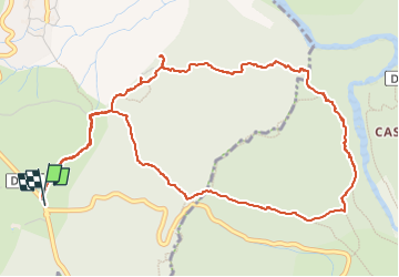
Trail Walking of 6.6 km to be discovered at Auvergne-Rhône-Alpes, Ardèche, Les Vans. This trail is proposed by jojo02.
Positioning
Country:
France
Region :
Auvergne-Rhône-Alpes
Department/Province :
Ardèche
Municipality :
Les Vans
Location:
Chassagnes
Start:(Dec)
Start:(UTM)
592999 ; 4916579 (31T) N.
Comments